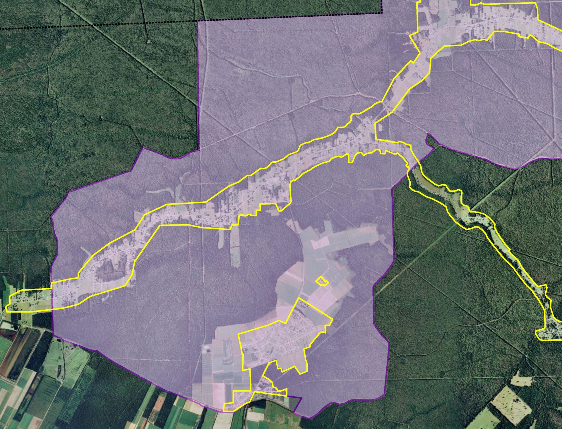
High Consequence Areas: Verification and Updates
Our specialty is helping pipeline operators verify and update HCAs. Answering questions such as:
- What sensitive resource does the HCA identify? Does it still exist?
- Is it mapped accurately? Does it still meet the regulatory definition of an HCA?
HCAs drive repair schedules. Repairs involve money, resources, and possible down time, which can be a big deal if the repair has to be done immediately. HCAs also drive spacing for expensive rupture mitigation valves. Verifying the location and legitimacy of HCAs can be a key tool for assessing risk and prioritizing resources – enhancing pipeline safety efforts while improving a company’s bottom line.
Risk ranking inherently has levels. High priority risk cannot be everywhere. And High Consequence Areas are not everywhere either. Please contact us to learn more about the HCAs in your area.
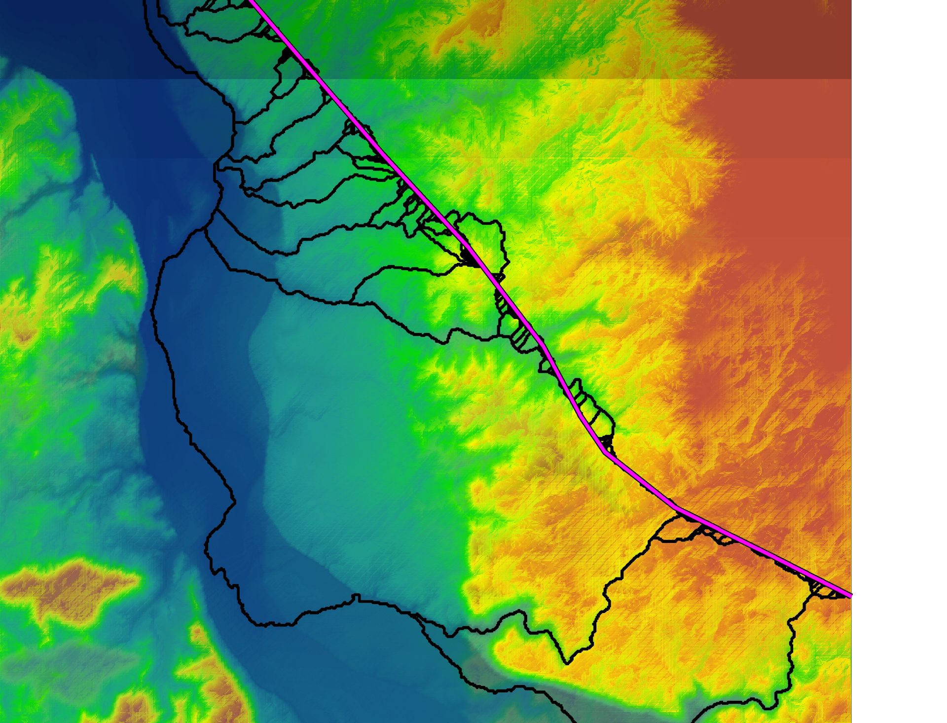
Segment Identification and Spill Modeling
Our practical approach to HCA Segment Identification is time tested and cost effective. Using our proprietary ArcGIS Pro Spill Modeling Toolset, we calculate draindown along the pipe – considering terrain, soil type, land cover, and waterborne transport to model spills overland and downstream. Our approach produces common-sense spill scenarios that reveal the direction and speed of transport from hypothetical releases along the pipe. We couple expert knowledge about the HCAs that are geospatially intersected by spill plumes to determine which pipe segments are likely to affect a valid HCA.
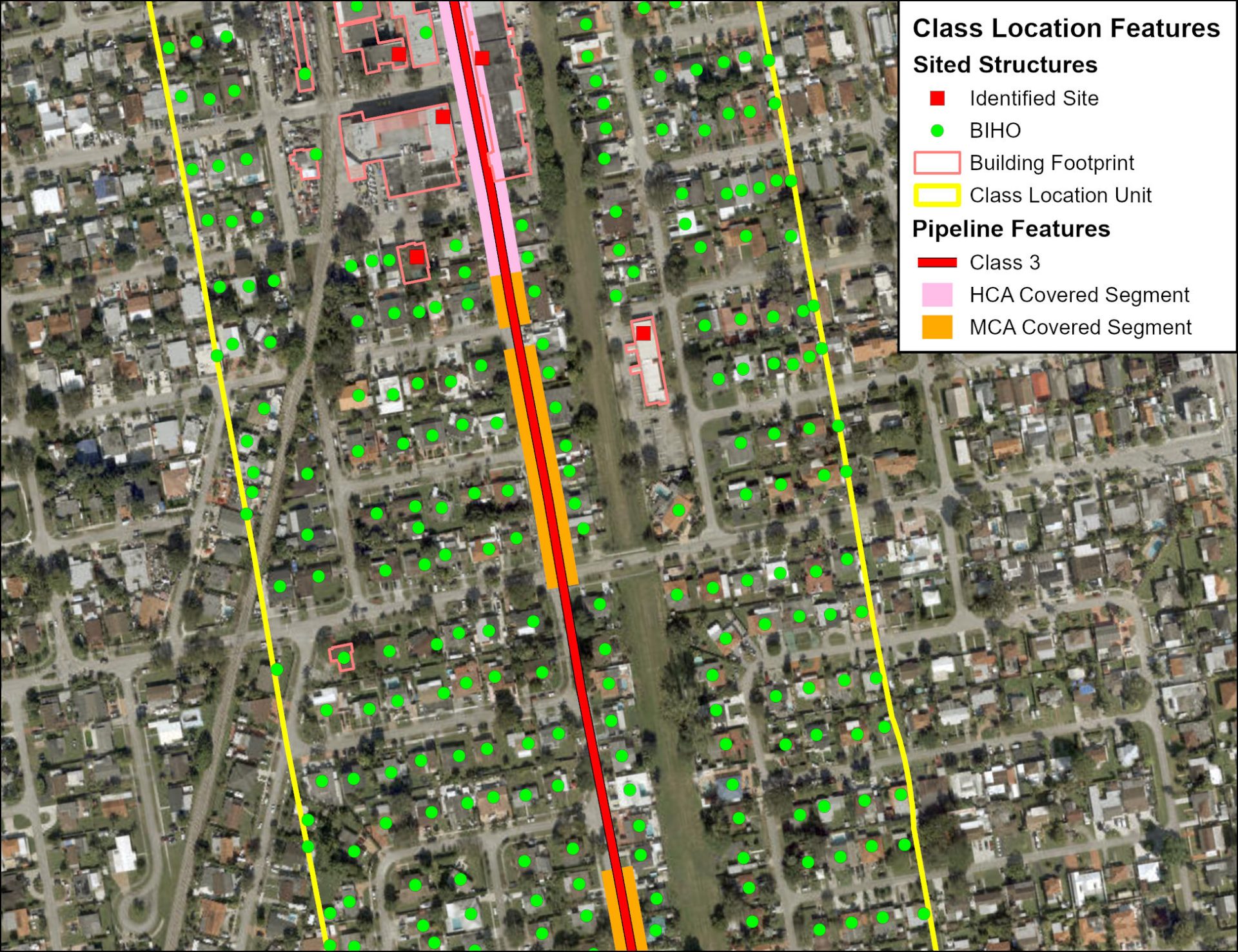
Gas HCAs and Class Locations
Natural gas high consequence areas (HCAs), moderate consequence areas (MCAs), and class locations identify population density along a pipeline, which is a key factor in the development and implementation of mandated pipeline integrity management programs.
FreemanGIS has developed geospatial routines to identify HCAs, MCAs, and class locations along natural gas pipelines. Our straight-forward approach applies the definitions in pipeline safety regulations (USDOT 49 CFR 192.903, 192.3, and 192.5) in an effective, sound, and repeatable manner.
Address
405 E Emma St,
Lafayette, CO 80026
USA
© 2025 FreemanGIS, Inc.